VRcollab's mini-map placed at the top left corner of the user interface aid users in orientating themselves within their BIM models, with functional elements such as comment legend, instant movement and level overview.
Accessing the mini-map
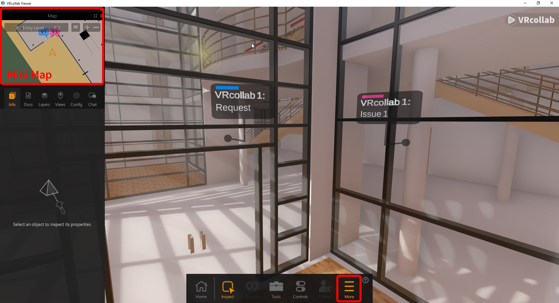
When viewing the project, to access the mini-map click on "More" on the bottom User Interface, an inner menu will then slide on from the left of the screen and the mini-map will be at the top as shown in the image below.
Mini-map Functions
The following is the mini-map functionality:
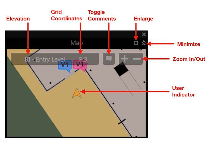
- Elevation: Allows user to instantly teleport to elevation level from a drop down with levels as defined in the BIM Model.
- Grid Coordinates: Allows user to instantly teleport to coordinate from a drop down as defined in the BIM model, grid coordinates need to be set up properly in the BIM model.
- Toggle Comment: Toggles comment representations created on mini-map on the same user elevation level, comment representations can be clicked on to teleport to the comment. Characters shown on comment bubble is the initials of the user's first and last name.
- Enlarge: Open Enlarged Map**
- Minimize: Hides mini-map from user interface until user unhides mini-map
- Zoom In/Out: Zoom in and out of model from a plan view
- User Indicator: Indicates users position and orientation in the model
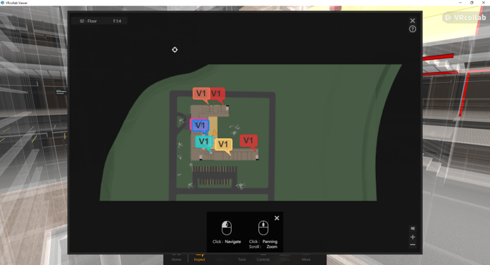
Enlarged Map** Functions
The following is the enlarged map functionality:
- Mini-map Functionality Carry Over: Icons similar to that of the mini-map retain thier uses on the Enlarged map
- Left Mouse Click: Clicking on the map will teleport user instantly to the location on the same starting elevation level before the click
- Scrolling: Zoom in and out relative to the middle of the screen
- Scroll Button Click: Panning of Model Plan view